
We are pleased to announce the launch of the geoSABINA Ecuador Geoportal, an open-access tool for exploring the current and future climatic suitability and the restoration potential of 199 native forest species of continental Ecuador. The geoportal is the result of the Connect-Wild project and Robinson Herrera-Feijoo’s doctoral thesis, and it aims to support species selection for forest restoration.
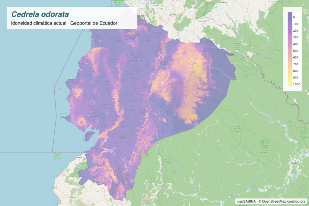
The maps, at a resolution of approximately 1 km, come from spatially nested species distribution models (N-SDM) built with the sabinaNSDM R package. This approach integrates broad-extent distribution records with a regional model fitted to Ecuador, which reduces niche truncation: in the preprint, the nested models consistently outperformed regional-only models (AUC = 0.95 vs. 0.83).
The viewer offers two query modes and several analysis tools:
- Climatic suitability: maps for each species under the current climate (1970–2000) and eight projections for 2050, combining two emission scenarios (SSP1-2.6 and SSP5-8.5) with four global climate models.
- Restoration Potential Index (IPR, from its Spanish acronym): a continuous score for each species in every cell that combines its current potential presence, the agreement among future climate projections and a score for documented attributes and uses (timber, human and animal food, medicinal use and support for agroforestry systems).
- Point query: lists of the ten species with the highest climatic suitability and the highest IPR at any location on the map.
- Downloads: maps in GeoTIFF format, for use in QGIS or ArcGIS, and query results in CSV.
The results show a widespread projected loss of climatic suitability for the analysed species and insufficient representation within the National System of Protected Areas, so passive conservation alone is not enough. The IPR distinguishes species of consolidated priority from those requiring urgent active propagation because of their reduced current potential extent, and provides a spatially explicit infrastructure to support the implementation of Ecuador’s National Forest Restoration Plan and equivalent frameworks in the American tropics.
The geoportal is a decision-support tool: its results describe potential climatic suitability and documented attributes, and should be complemented with local information on the site, the origin of planting material and the needs of local communities.
For more information:
- Ecuador Geoportal viewer
- Ecuador Geoportal features (in Spanish)
- Preprint: Integrating nested species distribution models and multicriteria prioritization into an open-access geoportal for tropical forest restoration
Reference: Herrera-Feijoo, R. J., Morales-Barbero, J., Torres, B. and Mateo, R. G. (2026). Integrating nested species distribution models and multicriteria prioritization into an open-access geoportal for tropical forest restoration. Preprint.
This geoportal has been partially funded by the International Academic Program (IAP), in collaboration with the David Rockefeller Center for Latin American Studies (DRCLAS) at Harvard University, with the institutional support of the Universidad Autónoma de Madrid (UAM).